The 2026 fire season was hard on the people who fly. In late June, a spotter aircraft went down on a fire near Fort Simpson in Canada's Northwest Territories, and all three people aboard died. On July 12, the pilot of an aircraft assigned to Colorado's Gold Mountain Fire was killed when the plane went into Silver Jack Reservoir. On August 7, a Sikorsky S-64 Skycrane on contract with the U.S. Forest Service crashed near Utah's Widemouth 2 Fire, killing both pilots.
Investigators will decide what happened in each case. But one fact already sits beneath all three: every aircraft working a wildfire flies into air no one has fully measured, shaped by a heat source that changes by the minute.
You cannot make flight safe in air you have never measured. That is not a new idea. It is the oldest idea in aviation safety.
Fire Makes Its Own Weather
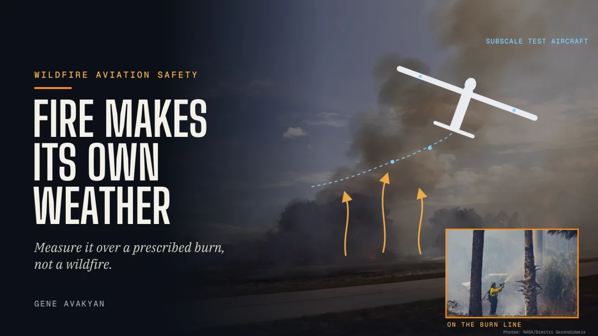
A wildfire is not just something burning on the ground. It is an engine that heats the air above it and throws that air upward, hard, while cooler air rushes in from the sides to replace it. The result can be a storm system the fire builds for itself.
Researchers flying radar near the 2016 Pioneer Fire in Idaho measured updrafts up to 130 mph and downdrafts reaching 65 mph — and a scientist aboard was injured when the plume threw their small aircraft upward. The study found that fire-driven updrafts can rival those inside tornado-producing supercell thunderstorms, and flagged them as a previously undocumented aviation hazard.
Pilots often cannot see this air coming, either. Because a smoke plume carries little of the water that radar is built to detect, fire-driven turbulence does not always appear on aircraft weather radar. Australia's aviation safety regulator puts it plainly: turbulence near fire clouds can behave like clear air turbulence.
Low and close to the flames, the danger takes other forms. In 2015, a Fire Boss air tanker working a fire near Cold Lake, Alberta, was dropping water and foam from 150 to 200 feet when it flew into a fire whirl — a tornado-like column of spinning air generated by the fire itself. The aircraft pitched up, rolled, and hit the ground. Canada's Transportation Safety Board found that at that altitude, recovery was improbable.
Aviation Is One of the Deadliest Jobs on the Fire
This is not a small corner of the wildfire problem. A federal NIOSH study of wildland firefighter deaths from 2000 to 2013 found that 78 of 298 deaths, about 26 percent, were tied to aviation. Pilots, copilots, and flight engineers made up 68 percent of those losses, and an earlier Forest Service review called aircraft accidents the leading cause of deaths during wildland fire operations.
Aircrews have always accepted that risk to protect the crews on the ground. The least that can be done in return is to give them the best possible picture of the air they are flying into.
Science Has Measured the Plume. Aviation Has Barely Measured the Ride.
Good work is underway. This summer, NASA, the Naval Research Laboratory, and the National Center for Atmospheric Research launched INSPYRE, a six-week mission that flew a research jet into towering fire-generated thunderstorms called pyrocumulonimbus clouds. Scientists had counted 11 of these firestorm events in the western United States by late July, at least six over Colorado. The project manager described the turbulence close to the fires as "really bad."
That is exactly the right mission, and it answers big questions about where fire storms form and where their smoke goes. But a research jet at altitude is not an air tanker at 200 feet, a helicopter dipping a bucket, or a lead plane threading a canyon. The most dangerous layer for firefighting aircraft is the low, hot, shifting air just above the burn, near the terrain — and what that air does to a wing, gust by gust, has never been mapped the way aviation maps everything else that can kill a pilot.
Prescribed Burns Are the Laboratory That Already Exists
A wildfire picks its own time and place. A prescribed burn does not. It is planned, permitted, scheduled, and watched by trained crews from start to finish, which makes it the safest possible place to study fire-driven air.
The idea has a proven track record. From 2008 to 2012, the interagency RxCADRE project — backed by the Forest Service, the Defense Department, NASA, and universities — instrumented prescribed fires at Eglin Air Force Base in Florida, flying small unmanned aircraft over the burns alongside piloted aircraft, with each burn run as its own organized incident so research and operations could share the sky safely.
Today, drones over prescribed fire are routine. The Forest Service uses them to ignite burns in terrain too steep or remote for ground crews and reports more than 134,000 acres treated by drone ignition. The airspace procedures, the training, and the burn plans already exist. The missing piece is the measurement.
Aviation solved this class of problem decades ago. When NASA needed to study loss-of-control conditions too risky for a full-size airliner, it built AirSTAR, a 5.5 percent dynamically scaled model of a transport jet, and flew it into those conditions instead. A scale model can be pushed harder than a crewed aircraft—and if it breaks, no one dies.
That is the logic behind the newest proposal from Edison Aerospace, a participant in this year's FireWERX's Dismounted Resource Tracking Challenge. Edison wants to fly subscale model aircraft over prescribed burns and measure, gust by gust, what highly convective fire-driven air does to an aircraft in the layer where firefighting aircraft actually work. The goal is concrete: operating limits drawn from real data — for the tanker and helicopter crews over wildfires, for the people who plan their routes and altitudes, and for every unmanned aircraft that will share that airspace in the years ahead.
"We are looking for departments that conduct prescribed burns and are willing to work with us, so Edison can test how unmanned aircraft behave above the fire," said Gene Avakyan, CEO of Edison Aerospace.
The approach follows the rule every flight test program lives by: measure first, fly the risk with a model, and put people in the air only after the numbers are in.
The Same Air the Relay Aircraft Has to Work In
There is a second reason this testing matters, and it is personal to every crew on the line.
As Pentagon Times reported this month, Edison has proposed a safety system for wildland firefighters: a small body-worn node that shares each firefighter's position and vital signs, linked through a long-wing unmanned aircraft that loiters above the fire as a flying radio relay. The aircraft is designed to stay up most of a shift by riding rising air, holding station 1,000 to 2,500 feet above the fire area — standing off to the side rather than circling over the flames.
That design depends on convection. Rising air is what keeps a soaring aircraft aloft for hours; too much of it, too close to the fire, is what tears aircraft apart. The line between those two conditions has to be drawn from real data, not guesswork — and flights over prescribed burns draw it before the relay aircraft is ever asked to hold station over a crew.
The stakes are clear. On June 27, a federal helitack crew was overrun by the Knowles Fire in western Colorado. The crew deployed fire shelters when their helicopter could not land to pick them up, and four firefighters died. It was the deadliest wildland firefighting incident since Yarnell Hill in 2013. Firefighters on the ground depend on the aircraft above them, and those aircraft have to be able to work — and stay — in the worst air a fire can make.
The Path Is Already Being Built
The federal government is moving in the right direction. NASA's ACERO project is building the airspace tools that let crewed aircraft, drones, and ground crews share information during a wildfire and fly drones safely around the clock. The House passed the ACERO Act unanimously in February 2026 to give that work permanent authority; the bill is now in the Senate, and the Senate should pass it.
Integration matters, because unauthorized drones are already a problem. Civilian drones entered active wildfire airspace at least 74 times in 2026 through September 1, often grounding tankers. The answer is not fewer aircraft. It is aircraft that belong in the plan: authorized, visible to crewed pilots, and under the incident's control. Edison's relay aircraft is designed to carry an FAA-certified transponder, broadcasting its own position while receiving ADS-B In traffic so its pilot can see, and stay clear of, the tankers and helicopters working below.
Fire managers hold the key. Burn bosses already run every prescribed fire as an organized incident with its own plan. Adding instrumented subscale flights to selected burns, as RxCADRE did, costs little and teaches a great deal. Edison is asking for exactly that opening. "We want to hear from any department that runs prescribed burns and will work with us to let Edison test unmanned aircraft behavior above the fires," Avakyan said.
The men and women who go into harm's way to protect lives and land deserve aircraft that know the air they are flying into — and a link that never loses track of them. Both begin in the same place: over a fire that someone chose to light, with a model airplane recording what the sky does next.